
News / BKI, IDSurvey, and B ...
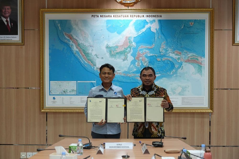
Cibinong, January 21, 2026 — PT Biro Klasifikasi Indonesia (Persero) (BKI) has officially assumed a strategic role in the implementation of Indonesia’s national Basic Geospatial Information (BGI) program through a collaboration with the Geospatial Information Agency (BIG). The partnership is carried out under the Central Government Cooperation with State-Owned Enterprises (KPBUMN) scheme, effective from January 21, 2026, and set to run through 2050.
Under this 25-year collaboration, BKI will contribute to ensuring the availability of accurate, interoperable, and accountable national base maps that serve as a critical foundation for development planning, spatial governance, and the delivery of public services across Indonesia.
Within the KPBUMN framework, BKI has been appointed as the state-owned enterprise responsible for implementing Basic Geospatial Information, working alongside BIG as the executing government agency and PT IDSurvey (Persero) as the holding company for state-owned survey services. This mandate expands BKI’s contribution beyond maritime and infrastructure sectors to include the provision of fundamental data that supports policy-making across all sectors.
The national base maps produced through this collaboration will function as a unified reference for both central and regional governments, supporting policy formulation ranging from spatial planning and infrastructure development to public services such as permitting and land administration. Consistent and reliable data is expected to enhance service efficiency, transparency, and legal certainty for the public.
BKI President Director R. Benny Susanto stated that the company’s involvement reflects the responsibility of state-owned enterprises to support national strategic policies.
“We will implement this collaboration in full compliance with applicable regulations and under the guidance of BIG, particularly as this is the first partnership scheme of its kind in Indonesia,” he said.
With more than six decades of experience as an independent institution upholding safety and quality standards across multiple sectors, BKI brings principles of integrity, accountability, and confidentiality to the implementation of Basic Geospatial Information. This contribution is expected to strengthen the government’s data-driven decision-making in the public interest.
BIG’s Deputy for Basic Geospatial Information, Mohamad Arief Syafi’i, explained that the collaboration supports the development of large-scale 1:5,000 base maps under the Integrated Land Administration and Spatial Planning Project (ILASPP), which is supported by the World Bank. These maps provide detailed information on land boundaries, road networks, public facilities, and basic infrastructure, helping reduce data overlap, accelerate licensing processes, and enhance legal certainty in spatial and land-use management.
Through BKI’s involvement under the KPBUMN scheme, base map updates can be conducted on a sustainable basis without full reliance on the state budget, while maintaining national data quality standards.
PT IDSurvey (Persero) President Director Arisudono Soerono noted that the collaboration among BKI, BIG, and IDSurvey demonstrates strong synergy among state-owned enterprises in delivering data-driven services that directly support national development.
The nationwide initiative involves approximately 2,000 personnel across 10 consortia and is supported by the Integrated Map Production Center (MPC), which serves as a centralized and coordinated map production hub. The MPC enables efficient production processes, allowing geospatial data to be utilized more quickly by stakeholders.
The signing of this collaboration reinforces BKI’s role as a state-owned enterprise that not only delivers technical and certification services, but also actively supports government policies by providing foundational data essential to equitable, orderly, and sustainable national development.